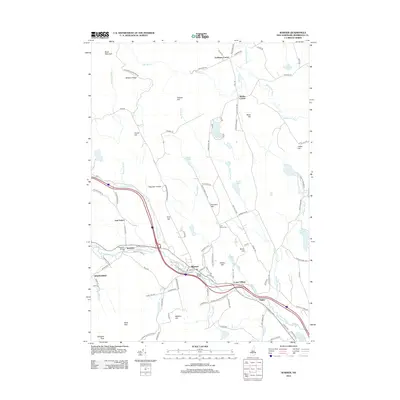
2012 Map of Warner
USGS Topo · Published 2012About this map
The Warner River and Blackwater River define the valley corridors of this Merrimack County landscape, where the town of Warner serves as a central hub. Historic crossings like Waterloo Bridge and Dalton Bridge reflect a long-standing transportation network that links the riverside settlements of Lower Village and Bagley. The terrain is characterized by numerous named peaks including Pumpkin Hill, Tory Hill, and the Mink Hills to the southwest, while the northern reaches transition into the highlands of Mission Ridge near Black Mountain. Genealogists and local historians can locate smaller community centers at Scribners Corner and Smiths Corner, alongside the quiet Coal Hearth Cem. Educational landmarks such as Magdalen College and the natural features of Lake Winnepocket and Tucker Pond further illustrate the area's mix of institutional and recreational land use in the early 21st century.
Find a feature on this map
114 named features on this map. Tap any name to fly to it.
Don’t see what you’re looking for? This feature index may not catch every label — zoom into the map to look around manually.
Map Details
Editions of this 2012 Warner Map
This is the sole edition of this map. No revisions or reprints were ever made.
Other maps of this area

1926 · Hillsboro
USGS Topo · 1:62,500

1927 · Concord
USGS Topo · 1:62,500

1927 · Penacook
USGS Topo · 1:62,500

1928 · Mount Kearsarge
USGS Topo · 1:62,500

1929 · Hillsboro
USGS Topo · 1:62,500

1931 · Mount Kearsarge
USGS Topo · 1:62,500

1949 · Portland
USGS Topo · 1:250,000

1949 · Concord
USGS Topo · 1:62,500

1956 · Penacook
USGS Topo · 1:62,500

1956 · Mt. Kearsarge
USGS Topo · 1:62,500