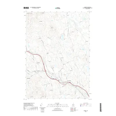
2018 Map of Warner
USGS Topo · Published 2018About this map
Warner and its surrounding hamlets sit along the winding path of the Warner River, where the landscape is defined by the significant rise of Mt Kearsarge and the Mink Hills. This 2018 survey details a cluster of traditional New England settlements including East Sutton, Lower Village, and Bagley, connected by historic crossing points like Waterloo Bridge and Dalton Bridge. The geography is notably varied, from the marshy lowlands of Knights Meadow Marsh to the high points of Black Mtn and Mission Ridge. Local landmarks such as Magdalen College and the Coal Hearth Cem reflect the community's cultural and educational layers. A dense network of brooks, including Barclay Brook and Schoodac Brook, drains these uplands into the river valley, illustrating the classic hydrological pattern that once powered the region's early development and continues to shape its rural residential character.
Find a feature on this map
98 named features on this map. Tap any name to fly to it.
Don’t see what you’re looking for? This feature index may not catch every label — zoom into the map to look around manually.
Map Details
Editions of this 2018 Warner Map
This is the sole edition of this map. No revisions or reprints were ever made.
Other maps of this area

1926 · Hillsboro
USGS Topo · 1:62,500

1927 · Concord
USGS Topo · 1:62,500

1927 · Penacook
USGS Topo · 1:62,500

1928 · Mount Kearsarge
USGS Topo · 1:62,500

1929 · Hillsboro
USGS Topo · 1:62,500

1931 · Mount Kearsarge
USGS Topo · 1:62,500

1949 · Portland
USGS Topo · 1:250,000

1949 · Concord
USGS Topo · 1:62,500

1956 · Penacook
USGS Topo · 1:62,500

1956 · Mt. Kearsarge
USGS Topo · 1:62,500