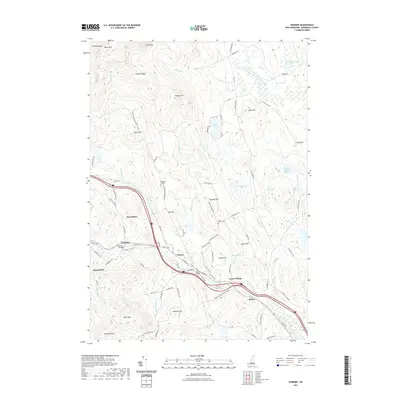
2021 Map of Warner
USGS Topo · Published 2021About this map
Warner and its surrounding hamlets follow the path of the Warner River through this section of Merrimack County. The landscape is defined by significant elevations like Mt Kearsarge and Black Mtn to the northwest, transitioning into a network of hills including Pumpkin Hill and the Mink Hills. Settlement patterns remain clustered around historic river crossings, evidenced by the Waterloo Bridge and Dalton Bridge. Local genealogy and land use are anchored by sites such as the Coal Hearth Cem and the presence of Magdalen College near the base of Tory Hill. The map also details numerous water bodies that shaped the local economy and geography, from the Blackwater River in the northeast to Tucker Pond and Bagley Pond.
Find a feature on this map
99 named features on this map. Tap any name to fly to it.
Don’t see what you’re looking for? This feature index may not catch every label — zoom into the map to look around manually.
Map Details
Editions of this 2021 Warner Map
This is the sole edition of this map. No revisions or reprints were ever made.
Other maps of this area

1926 · Hillsboro
USGS Topo · 1:62,500

1927 · Concord
USGS Topo · 1:62,500

1927 · Penacook
USGS Topo · 1:62,500

1928 · Mount Kearsarge
USGS Topo · 1:62,500

1929 · Hillsboro
USGS Topo · 1:62,500

1931 · Mount Kearsarge
USGS Topo · 1:62,500

1949 · Portland
USGS Topo · 1:250,000

1949 · Concord
USGS Topo · 1:62,500

1956 · Penacook
USGS Topo · 1:62,500

1956 · Mt. Kearsarge
USGS Topo · 1:62,500