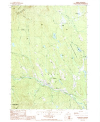
1987 Map of Warner
USGS Topo · Published 1987About this map
Warner River and the Blackwater River define the drainage of this Merrimack County landscape, where the village of Warner serves as a central hub. The terrain is notably defined by significant elevations and protected public lands, including the prominent heights of Mount Kearsarge and the associated Mount Kearsarge State Forest Park. Smaller clusters of settlement such as Waterloo, Lower Village, and Bagley are situated along the river corridors, tracing the historic movement and industry of the late 20th century.
Find a feature on this map
57 named features on this map. Tap any name to fly to it.
Don’t see what you’re looking for? This feature index may not catch every label — zoom into the map to look around manually.
Map Details
Editions of this 1987 Warner Map
This is the sole edition of this map. No revisions or reprints were ever made.
Other maps of this area

1926 · Hillsboro
USGS Topo · 1:62,500

1927 · Concord
USGS Topo · 1:62,500

1927 · Penacook
USGS Topo · 1:62,500

1928 · Mount Kearsarge
USGS Topo · 1:62,500

1929 · Hillsboro
USGS Topo · 1:62,500

1931 · Mount Kearsarge
USGS Topo · 1:62,500

1949 · Portland
USGS Topo · 1:250,000

1949 · Concord
USGS Topo · 1:62,500

1956 · Penacook
USGS Topo · 1:62,500

1956 · Mt. Kearsarge
USGS Topo · 1:62,500