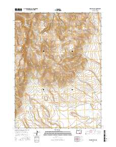
2017 Map of Warner Peak
USGS Topo · Published 2017About this map
Warner Peak and Hart Mtn dominate this high-desert landscape in Lake County, where seasonal water sources and complex drainage systems define the local geography. The area is characterized by a network of steep canyons, including the North Fork DeGarmo Canyon and Black Canyon, which fall away from the prominent ridges. Several perennial and intermittent water features, such as Hot Springs, Cottonwood Spring, and Indian Springs, provide vital resources in an otherwise arid environment.
Find a feature on this map
33 named features on this map. Tap any name to fly to it.
Don’t see what you’re looking for? This feature index may not catch every label — zoom into the map to look around manually.
Map Details
Editions of this 2017 Warner Peak Map
This is the sole edition of this map. No revisions or reprints were ever made.
Other maps of this area

1955 · Adel
USGS Topo · 1:250,000

1957 · Adel
USGS Topo · 1:250,000

1958 · Adel
USGS Topo · 1:250,000

1962 · Adel
USGS Topo · 1:250,000

1967 · Flagstaff Lake
USGS Topo · 1:24,000

1967 · Jacobs Reservoir
USGS Topo · 1:24,000

1967 · Campbell Lake
USGS Topo · 1:24,000

1967 · Flook Lake
USGS Topo · 1:24,000

1967 · Alger Lake
USGS Topo · 1:24,000

1967 · Hart Lake
USGS Topo · 1:24,000