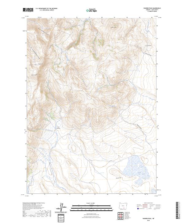
2024 Map of Warner Peak
USGS Topo · Published 2024About this map
Hart Mountain National Antelope Refuge dominates this high-desert landscape in Lake County, where steep fault-block escarpments rise toward Warner Peak and Hart Mtn. The terrain is defined by a series of dramatic drainages, including North Fork DeGarmo Canyon and South Fork DeGarmo Canyon, which carve through the volcanic uplands. These canyons provide a stark contrast to the broader basins like Spanish Flat, which contains the ephemeral Spanish Lake.
Find a feature on this map
31 named features on this map. Tap any name to fly to it.
Don’t see what you’re looking for? This feature index may not catch every label — zoom into the map to look around manually.
Map Details
Editions of this 2024 Warner Peak Map
This is the sole edition of this map. No revisions or reprints were ever made.
Other maps of this area

1955 · Adel
USGS Topo · 1:250,000

1957 · Adel
USGS Topo · 1:250,000

1958 · Adel
USGS Topo · 1:250,000

1962 · Adel
USGS Topo · 1:250,000

1967 · Flagstaff Lake
USGS Topo · 1:24,000

1967 · Jacobs Reservoir
USGS Topo · 1:24,000

1967 · Campbell Lake
USGS Topo · 1:24,000

1967 · Flook Lake
USGS Topo · 1:24,000

1967 · Alger Lake
USGS Topo · 1:24,000

1967 · Hart Lake
USGS Topo · 1:24,000