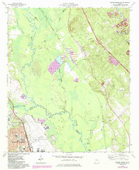
1973 Map of Warner Robins NE
USGS Topo · Published 1984About this map
Robins Air Force Base dominates the southwestern landscape of this survey, featuring its Control Tower, extensive runway systems, and street networks like Ignico Drive and Beale Drive. The base sits adjacent to Warner Robins and the community of Elberta, where residential expansion is noted through 1980s photorevisions. To the east, the terrain shifts abruptly into the river bottoms of the Ocmulgee River, a winding corridor defined by Bond Swamp and Denson Marsh. This area reveals a significant industrial footprint with several claypits and large tailings ponds near Huber. The map provides a detailed view of local spiritual and educational foundations, including Bethlehem Ch and Elberta Sch, alongside rural river landmarks like Jack Hole and Bullard Landing along the Bibb, Twiggs, and Houston county lines.
Find a feature on this map
58 named features on this map. Tap any name to fly to it.
Don’t see what you’re looking for? This feature index may not catch every label — zoom into the map to look around manually.
Map Details
Editions of this 1973 Warner Robins NE Map
2 editions found
Other maps of this area

1956 · Gordon
USGS Topo · 1:62,500

1956 · Warner Robins
USGS Topo · 1:62,500

1956 · Jeffersonville
USGS Topo · 1:62,500

1956 · Macon West
USGS Topo · 1:24,000

1956 · Macon East
USGS Topo · 1:24,000

1956 · Macon
USGS Topo · 1:62,500

1957 · Macon
USGS Topo · 1:250,000

1958 · Macon
USGS Topo · 1:250,000

1964 · Macon
USGS Topo · 1:250,000

1973 · Warner Robins NE
USGS Topo · 1:24,000