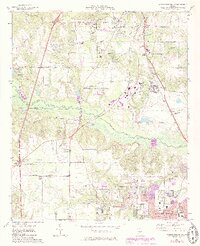
1973 Map of Warner Robins NW
USGS Topo · Published 1985About this map
Warner Robins and Centerville anchor the southeastern corner of this landscape, showing significant suburban expansion during the early 1980s. The map illustrates a region transitioning from rural agriculture and swampy bottomlands along Echeconnee Creek to an active transportation and recreation hub. Key infrastructure includes the Lewis B Wilson Airport and two notable racing venues: the Middle Georgia Raceway and the International City Speedway.
Find a feature on this map
64 named features on this map. Tap any name to fly to it.
Don’t see what you’re looking for? This feature index may not catch every label — zoom into the map to look around manually.
Map Details
Editions of this 1973 Warner Robins NW Map
3 editions found
Other maps of this area

1956 · Fort Valley
USGS Topo · 1:62,500

1956 · Bolingbroke
USGS Topo · 1:62,500

1956 · Warner Robins
USGS Topo · 1:62,500

1956 · Macon West
USGS Topo · 1:24,000

1956 · Macon East
USGS Topo · 1:24,000

1956 · Macon
USGS Topo · 1:62,500

1957 · Macon
USGS Topo · 1:250,000

1958 · Macon
USGS Topo · 1:250,000

1964 · Macon
USGS Topo · 1:250,000

1973 · Warner Robins NE
USGS Topo · 1:24,000