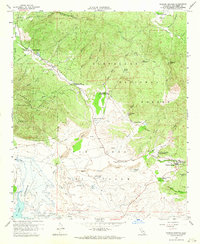
1959 Map of Warner Springs
USGS Topo · Published 1964About this map
Warner Springs serves as the focal point for this 1950s study of the high desert and mountain transition in San Diego County. The landscape is defined by the broad Valle De San Jose (Portilla) and the waters of Lake Henshaw at the southwestern edge, an area subject to controlled inundation. The map reveals a distinct military and institutional presence during the Cold War era, including the U S Navy Survival Training School and several sites for the Puerta La Cruz Conservation Camp.
Find a feature on this map
41 named features on this map. Tap any name to fly to it.
Don’t see what you’re looking for? This feature index may not catch every label — zoom into the map to look around manually.
Map Details
Editions of this 1959 Warner Springs Map
4 editions found
Other maps of this area

1903 · Ramona
USGS Topo · 1:125,000

1904 · Southern California Sheet No. 2
USGS Topo · 1:250,000

1939 · Warner Springs
USGS Topo · 1:62,500

1939 · Santa Ysabel
USGS Topo · 1:62,500

1939 · Palomar Mountain
USGS Topo · 1:62,500

1942 · Ramona
USGS Topo · 1:62,500

1943 · Santa Ysabel
USGS Topo · 1:62,500

1943 · Warner Springs
USGS Topo · 1:62,500

1947 · Ramona
USGS Topo · 1:62,500

1947 · Santa Ana
USGS Topo · 1:250,000