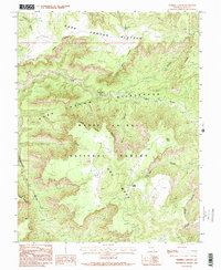
1985 Map of Warren Canyon
USGS Topo · Published 1985About this map
Dark Canyon Wilderness dominates this mid-1980s provisional study of the San Juan highlands, showing a landscape defined by deep drainages and high plateaus. The survey captures the intricate topographical detail of the Manti-La Sal National Forest, where significant water sources like Sweet Alice Spring and Cooper Spring provide critical landmarks in a semi-arid environment. The mapping of the Dry Mesa and the surrounding Sweet Alice Hills reflects the late-20th-century emphasis on identifying wilderness boundaries and managing remote federal lands. Geographic features such as Warren Canyon, Woodenshoe Canyon, and Youngs Canyon illustrate the complex erosion patterns that characterize this region. This 1985 edition, produced from earlier aerial photography, serves as a specialized record of the area's physical geography before modern digital revisions.
Find a feature on this map
17 named features on this map. Tap any name to fly to it.
Don’t see what you’re looking for? This feature index may not catch every label — zoom into the map to look around manually.
Map Details
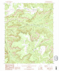
Editions of this 1985 Warren Canyon Map
2 editions found
Other maps of this area

1886 · Henry Mountains
USGS Topo · 1:250,000

1886 · Abajo
USGS Topo · 1:250,000

1892 · Abajo
USGS Topo · 1:250,000

1892 · Henry Mountains
USGS Topo · 1:250,000

1893 · Abajo
USGS Topo · 1:250,000

1935 · Elk Ridge
USGS Topo · 1:96,000

1940 · Elk Ridge
USGS Topo · 1:125,000

1952 · Mouth of Dark Canyon
USGS Topo · 1:62,500

1952 · Natural Bridges
USGS Topo · 1:62,500
1954 · White Canyon 1 NE
USGS Topo · 1:24,000