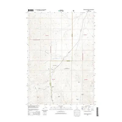
2013 Map of Warren Mountain
USGS Topo · Published 2013About this map
Warren Mtn and the high elevations of the Lost River Range dominate this 2013 survey of the border between Custer and Butte counties. The landscape is defined by the high-altitude pass at Pass Creek Summit, where Pass Creek Rd provides a primary route through the steep terrain of the Challis National Forest. This area serves as a critical watershed, with numerous named drainages such as Massacre Cr, Wagon Box Cr, and Chicken Cr carving deep into the mountainsides. To the east, the topography transitions into notable geological depressions including Little Basin and the Wet Creek Basin. The map meticulously details a network of forest service and development roads, such as Nat For Dev Rd 539, which provide access to remote areas like Larkspur Canyon and Black Tail Canyon.
Find a feature on this map
32 named features on this map. Tap any name to fly to it.
Don’t see what you’re looking for? This feature index may not catch every label — zoom into the map to look around manually.
Map Details
Editions of this 2013 Warren Mountain Map
This is the sole edition of this map. No revisions or reprints were ever made.
Other maps of this area

1935 · MacKay
USGS Topo · 1:96,000

1935 · Borah Peak
USGS Topo · 1:125,000

1938 · Borah Peak
USGS Topo · 1:125,000

1940 · Mackay
USGS Topo · 1:62,500

1955 · Dubois
USGS Topo · 1:250,000

1955 · Idaho Falls
USGS Topo · 1:250,000

1957 · Hawley Mountain
USGS Topo · 1:62,500

1958 · Dubois
USGS Topo · 1:250,000

1958 · Idaho Falls
USGS Topo · 1:250,000

1960 · Mackay
USGS Topo · 1:62,500