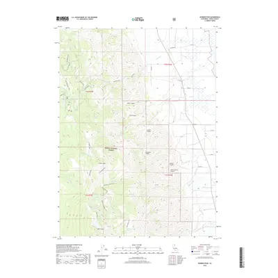
2018 Map of Warren Peak
USGS Topo · Published 2018About this map
Warren Peak and Squaw Peak anchor the high-elevation terrain of this portion of the Modoc National Forest, where steep drainage systems define the landscape. The western half of the map is dominated by a complex network of trails, including the prominent Summit Trail, which connects remote alpine basins such as those holding Patterson Lake and Cottonwood Lake. The presence of Tom Lee Meadows and various family-named canyons like Kaiser Canyon and Conklin Canyon suggests a history of grazing and localized land use within these mountain draws.
Find a feature on this map
44 named features on this map. Tap any name to fly to it.
Don’t see what you’re looking for? This feature index may not catch every label — zoom into the map to look around manually.
Map Details
Editions of this 2018 Warren Peak Map
This is the sole edition of this map. No revisions or reprints were ever made.
Other maps of this area

1886 · Alturas
USGS Topo · 1:250,000

1892 · Alturas
USGS Topo · 1:250,000

1954 · Alturas
USGS Topo · 1:250,000

1958 · Alturas
USGS Topo · 1:250,000

1962 · Alturas
USGS Topo · 1:250,000

1962 · Davis Creek
USGS Topo · 1:62,500

1962 · Cedarville
USGS Topo · 1:62,500

1963 · Warren Peak
USGS Topo · 1:24,000
1963 · Hansen Island
USGS Topo · 1:24,000
1963 · Eagleville
USGS Topo · 1:24,000