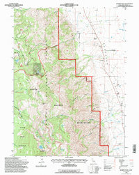
1993 Map of Warren Peak
USGS Topo · Published 1997About this map
The Warner Mountains dominate this 1993 revision, creating a dramatic topographical divide between high alpine lakes and the arid Surprise Valley to the east. Within the South Warner Wilderness, high-elevation features like Patterson Lake, Warren Peak, and Squaw Peak overlook a complex network of glacial cirques and drainages including Steamboat Canyon Creek and Cottonwood Creek. The transition from the Modoc National Forest down into the valley floor illustrates a managed landscape defined by water rights and ranching. A system of infrastructure including an Aqueduct, Flume, and Ditch networks supports low-lying agricultural operations like the Hereford Ranch, Benner Ranch, and Stimson Ranch. Traces of backcountry habitation and recreation are evident at Tom Lee Meadows and the Tom Smith Cabin, while a State Game Refuge occupies the southwestern slopes.
Find a feature on this map
54 named features on this map. Tap any name to fly to it.
Don’t see what you’re looking for? This feature index may not catch every label — zoom into the map to look around manually.
Map Details
Editions of this 1993 Warren Peak Map
This is the sole edition of this map. No revisions or reprints were ever made.
Other maps of this area

1886 · Alturas
USGS Topo · 1:250,000

1892 · Alturas
USGS Topo · 1:250,000

1954 · Alturas
USGS Topo · 1:250,000

1958 · Alturas
USGS Topo · 1:250,000

1962 · Alturas
USGS Topo · 1:250,000

1962 · Davis Creek
USGS Topo · 1:62,500

1962 · Cedarville
USGS Topo · 1:62,500

1963 · Warren Peak
USGS Topo · 1:24,000
1963 · Hansen Island
USGS Topo · 1:24,000
1963 · Eagleville
USGS Topo · 1:24,000