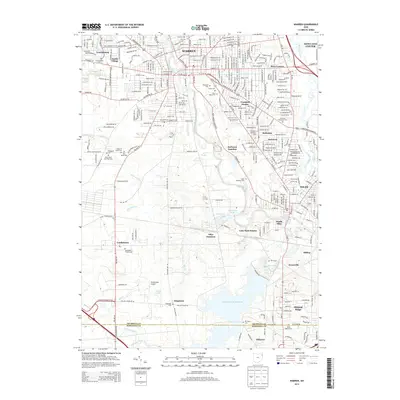
2013 Map of Warren
USGS Topo · Published 2013About this map
The Mahoning River winds through the industrial heart of the Mahoning Valley, anchoring a landscape defined by urban centers like Warren and Niles. This early 21st-century documentation illustrates the dense settlement patterns north of the Meander Creek Reservoir, where established neighborhoods like Austin Village and Bolindale meet historical transport nodes such as DeForest Junction. The map provides significant genealogical value through its detailed labeling of local burial grounds, ranging from the Welsh Baptist Cem and Saint Marys Cem to the House of Israel Cem and Paltzgroff Cem near Leavittsburg.
Find a feature on this map
83 named features on this map. Tap any name to fly to it.
Don’t see what you’re looking for? This feature index may not catch every label — zoom into the map to look around manually.
Map Details
Editions of this 2013 Warren Map
This is the sole edition of this map. No revisions or reprints were ever made.
Other maps of this area

1905 · Bristolville
USGS Topo · 1:62,500

1906 · Youngstown
USGS Topo · 1:62,500

1907 · Kinsman
USGS Topo · 1:62,500

1907 · Bristolville
USGS Topo · 1:62,500

1908 · Youngstown
USGS Topo · 1:62,500

1908 · Warren
USGS Topo · 1:62,500

1950 · Cleveland
USGS Topo · 1:250,000

1951 · Youngstown
USGS Topo · 1:24,000

1952 · Lake Milton
USGS Topo · 1:24,000

1952 · Canfield
USGS Topo · 1:24,000
Featured Places
- Warren, OH
- Weathersfield Township, OH
- Howland Township, OH
- Niles, Weathersfield Township
- Warren Township, OH