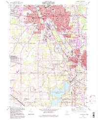
1994 Map of Warren
USGS Topo · Published 1997About this map
The Mahoning River winds through the industrial heart of northeast Ohio in this mid-1990s survey, anchoring the urban corridors of Warren and Niles. The landscape is a complex intersection of heavy rail infrastructure and residential growth, featuring the Niles and New Lisbon Railroad and key transit points like DeForest Junction and Niles Junction. To the south, the sprawling Meander Creek Reservoir provides a stark contrast to the dense street grids of the northern cities, with the Ohio Turnpike cutting across the southwestern corner near Lordstown.
Find a feature on this map
63 named features on this map. Tap any name to fly to it.
Don’t see what you’re looking for? This feature index may not catch every label — zoom into the map to look around manually.
Map Details
Editions of this 1994 Warren Map
This is the sole edition of this map. No revisions or reprints were ever made.
Other maps of this area

1905 · Bristolville
USGS Topo · 1:62,500

1906 · Youngstown
USGS Topo · 1:62,500

1907 · Kinsman
USGS Topo · 1:62,500

1907 · Bristolville
USGS Topo · 1:62,500

1908 · Youngstown
USGS Topo · 1:62,500

1908 · Warren
USGS Topo · 1:62,500

1950 · Cleveland
USGS Topo · 1:250,000

1951 · Youngstown
USGS Topo · 1:24,000

1952 · Lake Milton
USGS Topo · 1:24,000

1952 · Canfield
USGS Topo · 1:24,000
Featured Places
- Warren, OH
- Weathersfield Township, OH
- Howland Township, OH
- Niles, Weathersfield Township
- Warren Township, OH