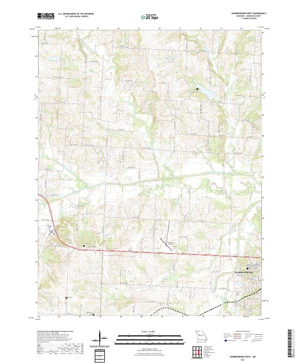
2021 Map of Warrensburg West
USGS Topo · Published 2021About this map
Warrensburg anchors the southeastern corner of this landscape, where the residential streets of W Gay St and W Market St meet the rolling countryside. This 2021 survey highlights a network of local roads and watercourses that define the western approaches to the city. The Blackwater River and its various tributaries, including the N-Fork Blackwater River and S Fork Blackwater River, wind through the central portion of the map, creating a complex drainage system characterized by small creeks like Honey Cr and Butcher Br.
Find a feature on this map
51 named features on this map. Tap any name to fly to it.
Don’t see what you’re looking for? This feature index may not catch every label — zoom into the map to look around manually.
Map Details
Editions of this 2021 Warrensburg West Map
This is the sole edition of this map. No revisions or reprints were ever made.
Other maps of this area

1885 · Warrensburg
USGS Topo · 1:125,000

1887 · Warrensburg
USGS Topo · 1:125,000

1894 · Warrensburg
USGS Topo · 1:125,000

1917 · Knobnoster
USGS Topo · 1:62,500

1947 · Jefferson City
USGS Topo · 1:250,000

1954 · Jefferson City
USGS Topo · 1:250,000

1954 · Centerview
USGS Topo · 1:24,000
1954 · Holden
USGS Topo · 1:24,000

1955 · Cornelia
USGS Topo · 1:24,000

1955 · Jefferson City
USGS Topo · 1:250,000