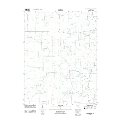
2012 Map of Warrenton NE
USGS Topo · Published 2012About this map
The watershed of Coon Creek and its many tributaries, including Meister Branch and Casmer Branch, defines this rural landscape northeast of Warrenton. Dozens of family-named roads like Aubuchon Rd, Mueller Ln, and Gerding Rd provide access to the dispersed homesteads and farms of eastern Lincoln County. For genealogists, the map is particularly detailed in its placement of historical burial grounds, ranging from the Old Davis Cemetery and Indian Camp Cemetery to the Douglas Cemetery and Slavens Cemetery.
Find a feature on this map
102 named features on this map. Tap any name to fly to it.
Don’t see what you’re looking for? This feature index may not catch every label — zoom into the map to look around manually.
Map Details
Editions of this 2012 Warrenton NE Map
This is the sole edition of this map. No revisions or reprints were ever made.
Other maps of this area

1890 · Louisiana
USGS Topo · 1:125,000

1890 · Hermann
USGS Topo · 1:125,000

1903 · O'Fallon
USGS Topo · 1:125,000

1934 · Elsberry
USGS Topo · 1:48,000

1937 · Silex
USGS Topo · 1:62,500

1939 · Silex
USGS Topo · 1:48,000

1941 · Troy
USGS Topo · 1:62,500

1942 · Elsberry
USGS Topo · 1:62,500

1943 · Warrenton
USGS Topo · 1:62,500

1945 · Troy
USGS Topo · 1:62,500