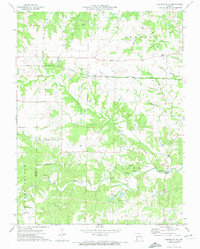
1973 Map of Warrenton NE
USGS Topo · Published 1974About this map
Lincoln and Warren counties meet in this 1970s landscape defined by the winding course of Big Creek and its many tributaries. The area is marked by a scattering of family and community burial grounds, including the Old Davis Cem, Slavens Cem, and Harvey Cem, which provide significant points of interest for genealogical research in this rural Missouri region. The Burlington Northern railroad cuts through the northern sections, passing the high ground at Hawk Point and intersecting with smaller watercourses like Cottonwood Branch and Whitcomb Branch. Local social and religious life is anchored by the Big Creek Community Center and sites such as Kingdom Hall. The southern portion of the map shows the transition into more dissected terrain near Indian Camp Cem and the waters of Hickory Lick Creek.
Find a feature on this map
31 named features on this map. Tap any name to fly to it.
Don’t see what you’re looking for? This feature index may not catch every label — zoom into the map to look around manually.
Map Details
Editions of this 1973 Warrenton NE Map
This is the sole edition of this map. No revisions or reprints were ever made.
Other maps of this area

1890 · Louisiana
USGS Topo · 1:125,000

1890 · Hermann
USGS Topo · 1:125,000

1903 · O'Fallon
USGS Topo · 1:125,000

1934 · Elsberry
USGS Topo · 1:48,000

1937 · Silex
USGS Topo · 1:62,500

1939 · Silex
USGS Topo · 1:48,000

1941 · Troy
USGS Topo · 1:62,500

1942 · Elsberry
USGS Topo · 1:62,500

1943 · Warrenton
USGS Topo · 1:62,500

1945 · Troy
USGS Topo · 1:62,500