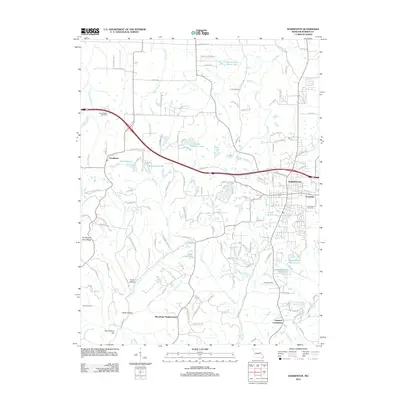
2012 Map of Warrenton
USGS Topo · Published 2012About this map
The county seat of Warrenton serves as the focal point for this eastern Missouri landscape, situated where the high ground transitions into the drainage basins of Big Creek and Dry Fork. The map documents the residential expansion of the early twenty-first century, seen in the Macedonia Neighborhood and Lippstadt Community, while preserving the locations of ancestral sites such as Holy Rosary Cemetery and the remote Rattle Cemetery. Transportation is dominated by the corridor of N Service Rd, which mirrors the interstate route passing north of Pendleton. The topography is marked by significant elevation changes at Pendleton Gore Ridge and Roundabout Hill, with numerous small water bodies like Birkemeier Lake and Givens Number 1 Lake dotting the terrain. This survey provides a precise look at the rural-to-suburban shift in Warren County before more recent developments further altered the footprint of the original settlements.
Find a feature on this map
123 named features on this map. Tap any name to fly to it.
Don’t see what you’re looking for? This feature index may not catch every label — zoom into the map to look around manually.
Map Details
Editions of this 2012 Warrenton Map
This is the sole edition of this map. No revisions or reprints were ever made.
Other maps of this area

1890 · Hermann
USGS Topo · 1:125,000

1936 · Hermann
USGS Topo · 1:48,000

1942 · Hermann
USGS Topo · 1:62,500

1942 · New Florence
USGS Topo · 1:62,500

1943 · Warrenton
USGS Topo · 1:62,500

1945 · Hermann
USGS Topo · 1:62,500

1945 · Warrenton
USGS Topo · 1:62,500

1946 · New Florence
USGS Topo · 1:62,500

1948 · Washington
USGS Topo · 1:62,500

1949 · Saint Louis
USGS Topo · 1:250,000