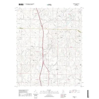
2018 Map of Warrior
USGS Topo · Published 2018About this map
The Locust Fork of the Black Warrior River winds through this portion of Jefferson and Blount Counties, anchoring a landscape defined by several established communities. The industrial and residential development of Warrior, Kimberly, and Morris is clearly visible alongside the modern transportation corridor, while older settlements like Beltona, Linton, and Coaldale maintain their distinct geographic identities. The map's detail provides significant value for local historians, documenting numerous family and community burial sites including Morris Cem, Enon Cem, and Brewer Cem.
Find a feature on this map
179 named features on this map. Tap any name to fly to it.
Don’t see what you’re looking for? This feature index may not catch every label — zoom into the map to look around manually.
Map Details
Editions of this 2018 Warrior Map
This is the sole edition of this map. No revisions or reprints were ever made.
Other maps of this area

1889 · Birmingham
USGS Topo · 1:125,000

1892 · Birmingham
USGS Topo · 1:125,000

1895 · Birmingham
USGS Topo · 1:125,000

1904 · Birmingham Coal District
USGS Topo · 1:62,500

1905 · Leeds
USGS Topo · 1:62,500

1906 · Birmingham Special
USGS Topo · 1:62,500

1907 · Birmingham
USGS Topo · 1:125,000

1907 · Leeds
USGS Topo · 1:62,500

1951 · Arkadelphia
USGS Topo · 1:24,000

1951 · Warrior
USGS Topo · 1:24,000