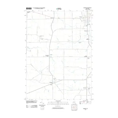
2010 Map of Warsaw
USGS Topo · Published 2010About this map
Warsaw serves as a primary hub within this Wyoming County landscape, where the valley of Oatka Creek meets a network of upland drainages. The area is characterized by several smaller clusters including Martinsville, South Warsaw, and Halls Corner, each connected by a grid of rural routes. For those researching local lineages, the map identifies numerous burial grounds such as the Quaker Meeting House Cemetery and German Cemetery, reflecting the varied community roots of the region. The southern portion of the quadrangle shows the hamlets of Hermitage and Gainesville situated along the winding path of East Koy Creek. This survey details the transition from town centers to more open spaces, such as the recreational area at Camp Weona, while tracking the numerous small waterways like Stony Brook and Relyea Creek that define the local topography.
Find a feature on this map
62 named features on this map. Tap any name to fly to it.
Don’t see what you’re looking for? This feature index may not catch every label — zoom into the map to look around manually.
Map Details
Editions of this 2010 Warsaw Map
This is the sole edition of this map. No revisions or reprints were ever made.
Other maps of this area

1904 · Batavia
USGS Topo · 1:62,500

1905 · Attica
USGS Topo · 1:62,500

1905 · Portage
USGS Topo · 1:62,500

1923 · Arcade
USGS Topo · 1:62,500

1925 · Arcade
USGS Topo · 1:62,500

1943 · Warsaw
USGS Topo · 1:24,000

1943 · Castile
USGS Topo · 1:24,000

1943 · Portageville
USGS Topo · 1:24,000

1943 · Pike
USGS Topo · 1:24,000

1944 · Pike
USGS Topo · 1:31,680