
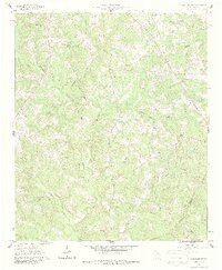
1961 Map of Warthen NW
USGS Topo · Published 1963About this map
The borderlands between Hancock and Washington Counties are defined by a dense network of watercourses and rural community centers. In the early 1960s, this landscape was anchored by numerous country churches such as Shiver Grove Ch and Knowles Chapel, serving scattered farmsteads. The terrain is deeply dissected by Buffalo Creek, Sandy Run Creek, and Pinkston Creek, with a series of fire breaks and jeep trails cutting through the timbered hills.
Find a feature on this map
25 named features on this map. Tap any name to fly to it.
Don’t see what you’re looking for? This feature index may not catch every label — zoom into the map to look around manually.
Map Details
Editions of this 1961 Warthen NW Map
2 editions found
Other maps of this area

1912 · Milledgeville
USGS Topo · 1:62,500

1953 · Athens
USGS Topo · 1:250,000

1958 · Athens
USGS Topo · 1:250,000

1959 · Athens
USGS Topo · 1:250,000

1960 · Warthen NE
USGS Topo · 1:24,000

1961 · Deepstep
USGS Topo · 1:24,000

1961 · Warthen
USGS Topo · 1:24,000

1963 · Athens
USGS Topo · 1:250,000

1972 · Shoulderbone
USGS Topo · 1:24,000
1972 · Jewell
USGS Topo · 1:24,000