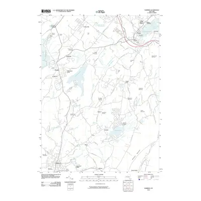
2010 Map of Warwick
USGS Topo · Published 2010About this map
The town of Warwick serves as the southern anchor for this portion of Orange County, where the landscape transitions from the broad valleys of Wawayanda Creek to the prominent heights of Bellvale Mountain. This era shows a region balancing its agrarian roots with modern residential and leisure expansion, evidenced by the presence of Applewood Orchards and the Red Swan Golf Course. The settlement pattern remains centered around established hubs like Florida, Chester, and Sugar Loaf, while smaller residential pockets like Hempstead Acres and Renee Gardens show the 21st-century footprint of the area.
Find a feature on this map
111 named features on this map. Tap any name to fly to it.
Don’t see what you’re looking for? This feature index may not catch every label — zoom into the map to look around manually.
Map Details
Editions of this 2010 Warwick Map
This is the sole edition of this map. No revisions or reprints were ever made.
Other maps of this area

1891 · Greenwood Lake
USGS Topo · 1:62,500

1891 · Ramapo
USGS Topo · 1:62,500

1893 · Greenwood Lake
USGS Topo · 1:62,500

1893 · Ramapo
USGS Topo · 1:62,500

1902 · Schunemunk
USGS Topo · 1:62,500

1903 · Greenwood Lake
USGS Topo · 1:62,500

1906 · Goshen
USGS Topo · 1:62,500

1908 · Goshen
USGS Topo · 1:62,500

1910 · Ramapo
USGS Topo · 1:62,500

1910 · Greenwood Lake
USGS Topo · 1:62,500