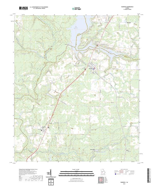
2024 Map of Warwick
USGS Topo · Published 2024About this map
Lake Blackshear and the Flint River dominate this landscape where the borders of Lee, Crisp, and Worth counties meet. The town of Warwick serves as a central hub, characterized by its residential grid including Peachtree St NE and Main St SW. Along the riverbanks, the historical site of Burke Ferry points to earlier modes of crossing before modern infrastructure. To the south, the settlement of Oakfield is marked by its proximity to the railroad and the Oakfield Cem. The map reveals a rural economy structured around water sources and small communities, with Davis Mill and Jordan Company Lake situated in the southern reaches. Numerous family and community burial sites, such as Fort Early Cem and the New Union Church Cem, provide significant markers for genealogical research across this agricultural terrain.
Find a feature on this map
73 named features on this map. Tap any name to fly to it.
Don’t see what you’re looking for? This feature index may not catch every label — zoom into the map to look around manually.
Map Details
Editions of this 2024 Warwick Map
This is the sole edition of this map. No revisions or reprints were ever made.
Other maps of this area

1953 · Dothan
USGS Topo · 1:250,000

1953 · Waycross
USGS Topo · 1:250,000

1954 · Dothan
USGS Topo · 1:250,000

1955 · Dothan
USGS Topo · 1:250,000

1956 · Sylvester
USGS Topo · 1:62,500

1956 · Albany
USGS Topo · 1:62,500

1956 · Leslie
USGS Topo · 1:62,500

1958 · Waycross
USGS Topo · 1:250,000

1972 · Cuffietown
USGS Topo · 1:24,000
1973 · Albany NE
USGS Topo · 1:24,000