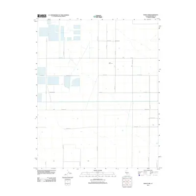
2012 Map of Wasco NW
USGS Topo · Published 2012About this map
Agricultural operations and large-scale ranching define this portion of Kern County in the early 21st century. The landscape is structured by an exacting grid of irrigation-focused roadways, including Wildwood Rd and Pond Rd, supporting significant local operations such as Costa Dairy Farms and the Schleifer Ranch near the northern boundary. Centrally, the perennial course of Poso Cr cuts across the geometric parcel lines, providing a natural contrast to the surrounding engineering of the San Joaquin Valley. Aviation interests are represented by the Cashen Airport, situated west of the major north-south artery of Bell Rd. The area demonstrates a highly developed rural infrastructure where family-named thoroughfares like Hanawalt Ave and Scofield Ave link specialized agricultural facilities and livestock operations to the regional transport network via Elmo Hwy.
Find a feature on this map
20 named features on this map. Tap any name to fly to it.
Don’t see what you’re looking for? This feature index may not catch every label — zoom into the map to look around manually.
Map Details
Editions of this 2012 Wasco NW Map
This is the sole edition of this map. No revisions or reprints were ever made.
Other maps of this area

1914 · Lost Hills
USGS Topo · 1:125,000

1927 · Semitropic
USGS Topo · 1:31,680

1929 · Hacienda Ranch
USGS Topo · 1:31,680

1929 · Stone
USGS Topo · 1:31,680

1929 · Allensworth
USGS Topo · 1:31,680

1930 · Leonards
USGS Topo · 1:31,680

1930 · Hamlin School
USGS Topo · 1:31,680

1930 · Wasco
USGS Topo · 1:31,680

1930 · Pond
USGS Topo · 1:31,680

1930 · Miramonte Ranch
USGS Topo · 1:31,680