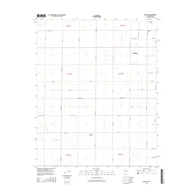
2015 Map of Wasco SW
USGS Topo · Published 2015About this map
Semitropic Ridge rises slightly above the flat expanses of the San Joaquin Valley, defining the topographic character of this agricultural landscape in the Central Valley. The western outskirts of Wasco appear in the northeast, where the grid of the town meets the broad section lines of the surrounding countryside. This survey captures a highly organized network of rural roads such as Kimberlina Rd and Mccombs Rd that facilitate the region's intense irrigation-based farming. Traces of the natural drainage system remain visible through Jerry Slough in the south, while modern residential developments are signaled by names like Augusta Manor Dr. The map illustrates the transition from concentrated municipal settlement to the sprawling ranch and field divisions that underpin the local economy.
Find a feature on this map
36 named features on this map. Tap any name to fly to it.
Don’t see what you’re looking for? This feature index may not catch every label — zoom into the map to look around manually.
Map Details
Editions of this 2015 Wasco SW Map
This is the sole edition of this map. No revisions or reprints were ever made.
Other maps of this area

1910 · Buena Vista Lake
USGS Topo · 1:125,000

1912 · McKittrick
USGS Topo · 1:125,000

1912 · Buena Vista Lake
USGS Topo · 1:125,000

1914 · Lost Hills
USGS Topo · 1:125,000

1927 · Semitropic
USGS Topo · 1:31,680

1930 · Leonards
USGS Topo · 1:31,680

1930 · Hamlin School
USGS Topo · 1:31,680

1930 · Wasco
USGS Topo · 1:31,680

1930 · Pond
USGS Topo · 1:31,680

1930 · Miramonte Ranch
USGS Topo · 1:31,680