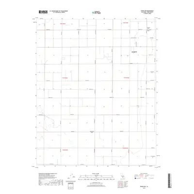
2018 Map of Wasco SW
USGS Topo · Published 2018About this map
Wasco sits at the northern edge of this survey in the heart of the San Joaquin Valley, surrounded by the geometric precision of California’s agricultural interior. The landscape is defined by an extensive grid of irrigation-supporting roads, including W Lerdo Hwy, Kimberlina Rd, and Dresser Ave, which divide the fertile plains of the Central Valley. A subtle rise in the southwest, the Semitropic Ridge, provides one of the few natural interruptions to the level terrain.
Find a feature on this map
38 named features on this map. Tap any name to fly to it.
Don’t see what you’re looking for? This feature index may not catch every label — zoom into the map to look around manually.
Map Details
Editions of this 2018 Wasco SW Map
This is the sole edition of this map. No revisions or reprints were ever made.
Other maps of this area

1910 · Buena Vista Lake
USGS Topo · 1:125,000

1912 · McKittrick
USGS Topo · 1:125,000

1912 · Buena Vista Lake
USGS Topo · 1:125,000

1914 · Lost Hills
USGS Topo · 1:125,000

1927 · Semitropic
USGS Topo · 1:31,680

1930 · Leonards
USGS Topo · 1:31,680

1930 · Hamlin School
USGS Topo · 1:31,680

1930 · Wasco
USGS Topo · 1:31,680

1930 · Pond
USGS Topo · 1:31,680

1930 · Miramonte Ranch
USGS Topo · 1:31,680