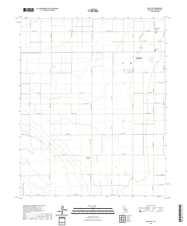
2021 Map of Wasco SW
USGS Topo · Published 2021About this map
Wasco sits at the eastern edge of this agricultural landscape in the Central Valley. The map reveals a highly structured grid of section lines and irrigation-adjacent roads, reflecting the intense land use of the San Joaquin Valley. To the west, the terrain rises slightly at Semitropic Ridge and Buttonwillow Ridge, creating a subtle vertical break in an otherwise level floor. Notable for local history and genealogy, the Wasco Cem is located north of the main settlement along Western Ave. Water management is evident through the winding path of Jerry Slough in the southwest corner, contrasting with the rigid geometry of thoroughfares like W Lerdo Hwy and Kimberlina Rd that define the region's transport network.
Find a feature on this map
40 named features on this map. Tap any name to fly to it.
Don’t see what you’re looking for? This feature index may not catch every label — zoom into the map to look around manually.
Map Details
Editions of this 2021 Wasco SW Map
This is the sole edition of this map. No revisions or reprints were ever made.
Other maps of this area

1910 · Buena Vista Lake
USGS Topo · 1:125,000

1912 · McKittrick
USGS Topo · 1:125,000

1912 · Buena Vista Lake
USGS Topo · 1:125,000

1914 · Lost Hills
USGS Topo · 1:125,000

1927 · Semitropic
USGS Topo · 1:31,680

1930 · Leonards
USGS Topo · 1:31,680

1930 · Hamlin School
USGS Topo · 1:31,680

1930 · Wasco
USGS Topo · 1:31,680

1930 · Pond
USGS Topo · 1:31,680

1930 · Miramonte Ranch
USGS Topo · 1:31,680