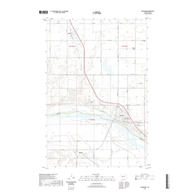
2020 Map of Washburn
USGS Topo · Published 2020About this map
The Missouri River serves as the dominant geographic and administrative divide on this sheet, separating McLean and Oliver Counties near the town of Washburn. As the county seat, Washburn is the most developed hub, anchored by the McLean County Courthouse and a grid of residential streets including Main St and Main Ave. The map documents a predominantly agrarian landscape punctuated by several community burial grounds, such as Riverview Cem, Baptist Cem, and the Zion German Lutheran Cem, which offer significant data for genealogical research in this region of North Dakota. To the north, the small settlement of Falkirk and the Washburn Municipal Airport stand amidst the drainage of Buffalo Cr, while south of the river, the hamlet of Hensler and the nearby Hensler Cem mark the quiet prairie interior. The inclusion of the Lewis & Clark Trl follows the river corridor, tracing the path of early explorers through the river valley.
Find a feature on this map
36 named features on this map. Tap any name to fly to it.
Don’t see what you’re looking for? This feature index may not catch every label — zoom into the map to look around manually.
Map Details
Editions of this 2020 Washburn Map
This is the sole edition of this map. No revisions or reprints were ever made.
Other maps of this area

1949 · Turtle Creek
USGS Topo · 1:62,500

1949 · Washburn
USGS Topo · 1:62,500

1950 · Wilton
USGS Topo · 1:62,500

1954 · McClusky
USGS Topo · 1:250,000

1958 · McClusky
USGS Topo · 1:250,000

1961 · Turtle Creek SW
USGS Topo · 1:24,000

1961 · Washburn
USGS Topo · 1:24,000

1961 · Washburn NE
USGS Topo · 1:24,000

1961 · Turtle Creek NW
USGS Topo · 1:24,000

1961 · Underwood
USGS Topo · 1:24,000