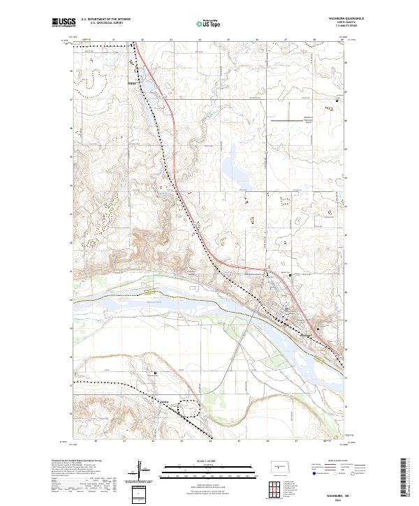
2024 Map of Washburn
USGS Topo · Published 2024About this map
The Missouri River carves a deep valley through this portion of North Dakota, separating the communities of Washburn and Hensler. As the county seat, Washburn serves as a local hub, anchored by the McLean County Courthouse and a cluster of community sites including Riverview Cem and the Baptist Cem. The map reveals a landscape defined by significant elevation changes between the river bottomlands and the surrounding bluffs, where Buffalo Creek meanders toward its confluence with the Missouri.
Find a feature on this map
34 named features on this map. Tap any name to fly to it.
Don’t see what you’re looking for? This feature index may not catch every label — zoom into the map to look around manually.
Map Details
Editions of this 2024 Washburn Map
This is the sole edition of this map. No revisions or reprints were ever made.
Other maps of this area

1949 · Turtle Creek
USGS Topo · 1:62,500

1949 · Washburn
USGS Topo · 1:62,500

1950 · Wilton
USGS Topo · 1:62,500

1954 · McClusky
USGS Topo · 1:250,000

1958 · McClusky
USGS Topo · 1:250,000

1961 · Turtle Creek SW
USGS Topo · 1:24,000

1961 · Washburn
USGS Topo · 1:24,000

1961 · Washburn NE
USGS Topo · 1:24,000

1961 · Turtle Creek NW
USGS Topo · 1:24,000

1961 · Underwood
USGS Topo · 1:24,000