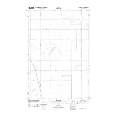
2011 Map of Washburn NE
USGS Topo · Published 2011About this map
Coal Lake serves as a central hydrological feature in this rural McLean County landscape, feeding into the surrounding drainage systems of Buffalo Creek and Coal Lake Coulee. The terrain is organized by a precise grid of section-line roads, such as 27th Ave NW and 5th St NW, which facilitate access across the open plains of North Dakota. This 2011 survey by the U.S. Geological Survey captures the area's agricultural character just before significant shifts in regional land use. The alignment of Main St W and Main St indicates a concentrated corridor of movement, likely serving the local farming community and connecting scattered homesteads to larger regional hubs beyond the quadrangle's borders.
Find a feature on this map
18 named features on this map. Tap any name to fly to it.
Don’t see what you’re looking for? This feature index may not catch every label — zoom into the map to look around manually.
Map Details
Editions of this 2011 Washburn NE Map
This is the sole edition of this map. No revisions or reprints were ever made.
Other maps of this area

1929 · Coleharbor
USGS Topo · 1:62,500

1947 · Turtle Lake
USGS Topo · 1:62,500

1949 · Turtle Creek
USGS Topo · 1:62,500

1949 · Washburn
USGS Topo · 1:62,500

1954 · McClusky
USGS Topo · 1:250,000

1958 · McClusky
USGS Topo · 1:250,000

1961 · Turtle Creek SW
USGS Topo · 1:24,000

1961 · Turtle Lake
USGS Topo · 1:24,000

1961 · Lake Nettie
USGS Topo · 1:24,000

1961 · Washburn
USGS Topo · 1:24,000