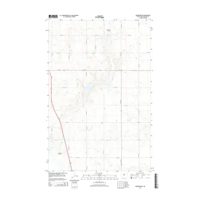
2014 Map of Washburn NE
USGS Topo · Published 2014About this map
Coal Lake and its surrounding drainage systems define this section of the North Dakota prairie within McLean County. The landscape is characterized by a network of seasonal watercourses and coulees, including the northern Coal Lake Coulee and its southern counterpart, Coal Lake Coulée. These landforms, along with the meandering path of Buffalo Cr, illustrate the subtle topographic variations of the region. The map shows a transition from the natural water features to a strictly organized grid of agricultural roads, such as Main St and 5th St NW, which segment the land into large parcels. Transportation through this rural corridor is facilitated by the intersection of Us-83 and ND-200, serving as the primary arteries for local commerce and travel across the plains.
Find a feature on this map
14 named features on this map. Tap any name to fly to it.
Don’t see what you’re looking for? This feature index may not catch every label — zoom into the map to look around manually.
Map Details
Editions of this 2014 Washburn NE Map
This is the sole edition of this map. No revisions or reprints were ever made.
Other maps of this area

1929 · Coleharbor
USGS Topo · 1:62,500

1947 · Turtle Lake
USGS Topo · 1:62,500

1949 · Turtle Creek
USGS Topo · 1:62,500

1949 · Washburn
USGS Topo · 1:62,500

1954 · McClusky
USGS Topo · 1:250,000

1958 · McClusky
USGS Topo · 1:250,000

1961 · Turtle Creek SW
USGS Topo · 1:24,000

1961 · Turtle Lake
USGS Topo · 1:24,000

1961 · Lake Nettie
USGS Topo · 1:24,000

1961 · Washburn
USGS Topo · 1:24,000