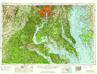
1961 Map of Washington
USGS Topo · Published 1961About this map
Washington and the expanding suburbs of Alexandria, Arlington, and Bethesda anchor this mid-century survey of the Mid-Atlantic region. The map captures the corridor before the full arrival of the modern interstate system, showing the early reach of Interstate 95 alongside historic routes like U S Highway 1 and the Pennsylvania RR. The landscape transitions from the urban center to the preservation lands of Prince William Forest Park and the deeply indented shorelines of the Potomac River and Chesapeake Bay.
Find a feature on this map
178 named features on this map. Tap any name to fly to it.
Don’t see what you’re looking for? This feature index may not catch every label — zoom into the map to look around manually.
Map Details
Editions of this 1961 Washington Map
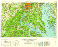
2 editions found
Other maps of this area

1884 · Harpers Ferry
USGS Topo · 1:125,000

1887 · Spottsylvania
USGS Topo · 1:125,000

1889 · Fredericksburg
USGS Topo · 1:125,000

1890 · Goochland
USGS Topo · 1:125,000

1890 · Mt. Vernon
USGS Topo · 1:125,000

1891 · Harpers Ferry
USGS Topo · 1:125,000

1891 · Palmyra
USGS Topo · 1:125,000

1891 · Mt. Vernon
USGS Topo · 1:125,000

1892 · Leonardtown
USGS Topo · 1:62,500

1892 · Laurel
USGS Topo · 1:62,500