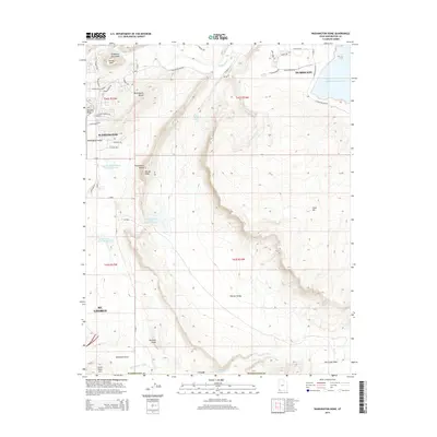
2014 Map of Washington Dome
USGS Topo · Published 2014About this map
Washington Dome and Warner Ridge dominate this corner of Washington County, where the expanding edges of Washington and St. George meet the high desert. The landscape is defined by its water management and dramatic geology, from the wide Virgin River in the north to the sprawling Sand Hollow Reservoir near Hurricane. This terrain is marked by distinct geological formations such as Shinob Kibe, Beehive Dome, and Punchbowl Dome, which rise above the broad flats of Warner Valley. Modern infrastructure is evident in the network of debris basins, including the Stucki Debris Basin Reservoir and Warner Draw Debris Basin Reservoir, built to manage seasonal runoff through the arid basins. These features, alongside Fort Pearce Wash and Dutchman Draw, illustrate the complex relationship between residential growth and the desert's natural drainage patterns.
Find a feature on this map
58 named features on this map. Tap any name to fly to it.
Don’t see what you’re looking for? This feature index may not catch every label — zoom into the map to look around manually.
Map Details
Editions of this 2014 Washington Dome Map
This is the sole edition of this map. No revisions or reprints were ever made.
Other maps of this area

1885 · St. George
USGS Topo · 1:250,000

1886 · Mt. Trumbull
USGS Topo · 1:250,000

1891 · St. George
USGS Topo · 1:250,000

1892 · Mt. Trumbull
USGS Topo · 1:250,000

1953 · Cedar City
USGS Topo · 1:250,000

1953 · Grand Canyon
USGS Topo · 1:250,000

1954 · Hurricane Cliffs 2 NW
USGS Topo · 1:24,000

1954 · La Verkin 3 NW
USGS Topo · 1:24,000

1954 · Hurricane Cliffs 2 NE
USGS Topo · 1:24,000

1954 · La Verkin 3 NE
USGS Topo · 1:24,000