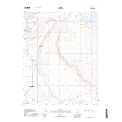
2020 Map of Washington Dome
USGS Topo · Published 2020About this map
Shinob Kibe and the distinctive geological formations of Washington Dome anchor this landscape, where the agricultural legacy of Washington Fields meets modern residential growth. The Saint-George and Washington Canal and Virgin River remain critical water features in this arid environment, defining the boundary between the rising suburbs and the open desert. The map captures a sophisticated network of water management, including the Gypsum Wash Debris Basin Reservoir and Stucki Debris Basin Reservoir, necessary for the expanding communities of Washington and St. George.
Find a feature on this map
51 named features on this map. Tap any name to fly to it.
Don’t see what you’re looking for? This feature index may not catch every label — zoom into the map to look around manually.
Map Details
Editions of this 2020 Washington Dome Map
This is the sole edition of this map. No revisions or reprints were ever made.
Other maps of this area

1885 · St. George
USGS Topo · 1:250,000

1886 · Mt. Trumbull
USGS Topo · 1:250,000

1891 · St. George
USGS Topo · 1:250,000

1892 · Mt. Trumbull
USGS Topo · 1:250,000

1953 · Cedar City
USGS Topo · 1:250,000

1953 · Grand Canyon
USGS Topo · 1:250,000

1954 · Hurricane Cliffs 2 NW
USGS Topo · 1:24,000

1954 · La Verkin 3 NW
USGS Topo · 1:24,000

1954 · Hurricane Cliffs 2 NE
USGS Topo · 1:24,000

1954 · La Verkin 3 NE
USGS Topo · 1:24,000