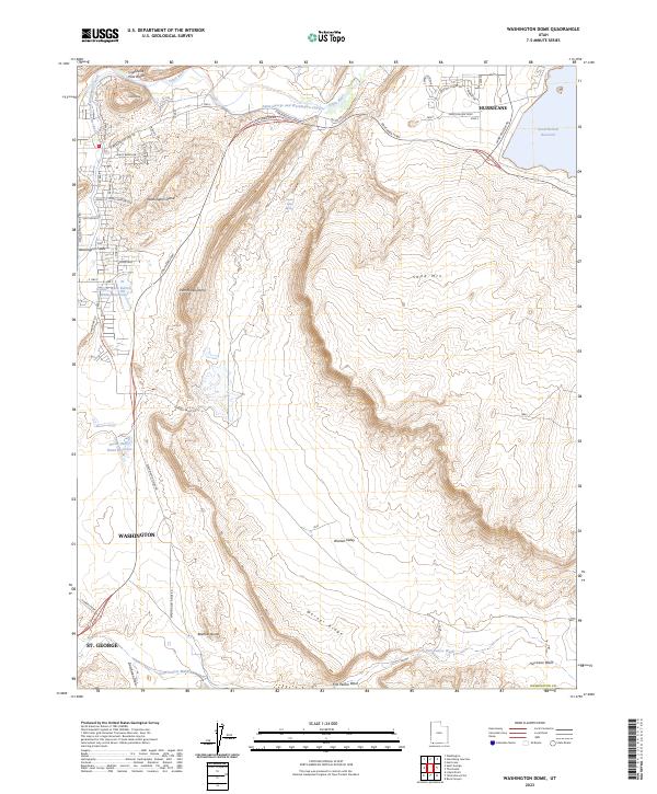
2023 Map of Washington Dome
USGS Topo · Published 2023About this map
Hurricane and Washington anchor this southwestern Utah landscape, where modern suburban development meets a complex network of arid drainage basins and water management. The Saint George and Washington Canal traces a path along the Virgin River, highlighting the long-standing importance of irrigation in this desert environment. Notable topographic landmarks such as Washington Dome, Punchbowl Dome, and the prominent Beehive Dome rise above the basin floor, defining the character of the Warner Valley. Further east, the Sand Hollow Reservoir stands as a significant hydrological feature adjacent to Sand Mountain, while infrastructure like the Southern Pkwy and S Washington Fields Rd illustrates the rapid expansion of St. George into the surrounding countryside. This survey captures a specific moment of growth as residential street grids and debris basins like the Stucki Debris Basin Reservoir begin to transform the historic ranching and wash lands of Washington County.
Find a feature on this map
51 named features on this map. Tap any name to fly to it.
Don’t see what you’re looking for? This feature index may not catch every label — zoom into the map to look around manually.
Map Details
Editions of this 2023 Washington Dome Map
This is the sole edition of this map. No revisions or reprints were ever made.
Other maps of this area

1885 · St. George
USGS Topo · 1:250,000

1886 · Mt. Trumbull
USGS Topo · 1:250,000

1891 · St. George
USGS Topo · 1:250,000

1892 · Mt. Trumbull
USGS Topo · 1:250,000

1953 · Cedar City
USGS Topo · 1:250,000

1953 · Grand Canyon
USGS Topo · 1:250,000

1954 · Hurricane Cliffs 2 NW
USGS Topo · 1:24,000

1954 · La Verkin 3 NW
USGS Topo · 1:24,000

1954 · Hurricane Cliffs 2 NE
USGS Topo · 1:24,000

1954 · La Verkin 3 NE
USGS Topo · 1:24,000