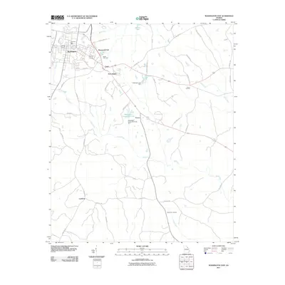
2011 Map of Washington East
USGS Topo · Published 2011About this map
Washington serves as the primary hub in this Georgia landscape, surrounded by a network of smaller residential areas and agricultural tracts. Pockets of development such as Ravenwood Park, Logan, and Anne Heights extend eastward from the town center, while smaller locales like Porters and Lundberg are situated further afield. The terrain is defined by the drainage patterns of Rocky Creek and its many tributaries, including Porters Branch and Threemile Creek.
Find a feature on this map
44 named features on this map. Tap any name to fly to it.
Don’t see what you’re looking for? This feature index may not catch every label — zoom into the map to look around manually.
Map Details
Editions of this 2011 Washington East Map
This is the sole edition of this map. No revisions or reprints were ever made.
Other maps of this area

1906 · Crawfordville
USGS Topo · 1:125,000

1953 · Athens
USGS Topo · 1:250,000

1954 · Metasville
USGS Topo · 1:24,000

1955 · Tignall
USGS Topo · 1:24,000

1958 · Athens
USGS Topo · 1:250,000

1959 · Athens
USGS Topo · 1:250,000

1963 · Athens
USGS Topo · 1:250,000
1971 · Celeste
USGS Topo · 1:24,000
1972 · Wrightsboro
USGS Topo · 1:24,000
1972 · Aonia
USGS Topo · 1:24,000