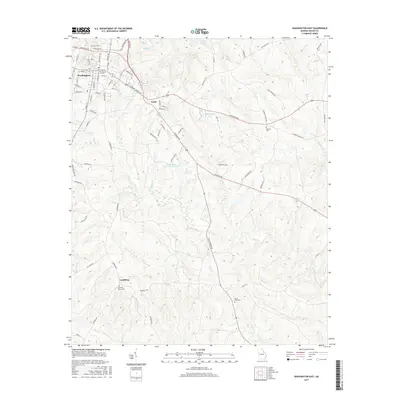
2017 Map of Washington East
USGS Topo · Published 2017About this map
Washington anchors the northwestern corner of this Georgia landscape, where the town's grid expands along historic corridors like E Robert Toombs Ave and S Jefferson St. Moving southeast, the terrain shifts into the rolling hydrology of the Wilkes County countryside, defined by the winding paths of Rocky Cr and Porters Br. The map reveals a pattern of local community life through small rural settlements like Logan and Lundberg, each situated near long-standing landmarks such as Smyrna Cem and Mount Zion Cem.
Find a feature on this map
79 named features on this map. Tap any name to fly to it.
Don’t see what you’re looking for? This feature index may not catch every label — zoom into the map to look around manually.
Map Details
Editions of this 2017 Washington East Map
This is the sole edition of this map. No revisions or reprints were ever made.
Other maps of this area

1906 · Crawfordville
USGS Topo · 1:125,000

1953 · Athens
USGS Topo · 1:250,000

1954 · Metasville
USGS Topo · 1:24,000

1955 · Tignall
USGS Topo · 1:24,000

1958 · Athens
USGS Topo · 1:250,000

1959 · Athens
USGS Topo · 1:250,000

1963 · Athens
USGS Topo · 1:250,000
1971 · Celeste
USGS Topo · 1:24,000
1972 · Wrightsboro
USGS Topo · 1:24,000
1972 · Aonia
USGS Topo · 1:24,000