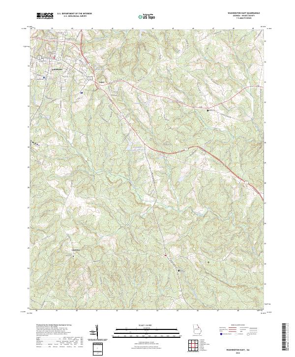
2024 Map of Washington East
USGS Topo · Published 2024About this map
The Wilkes County Courthouse stands at the urban heart of Washington, marking a transition from the structured street grid of the town center to the outlying timberlands and agricultural reaches of Wilkes County. This eastern quadrangle reveals a landscape defined by its water resources and small-scale settlements, including Logan and the southern area of Lundberg. Significant water bodies like Booth Lake and Shillinglaw Lake are tucked among the contours, while the broader drainage system is led by Rocky Creek and Upton Creek. For those researching local history or genealogy, the map identifies several rural burial sites, including Cliffords Grove Cem, Mount Zion Cem, and Symma Cem, which serve as quiet landmarks for the families who have long inhabited these wooded ridges and creek bottoms.
Find a feature on this map
79 named features on this map. Tap any name to fly to it.
Don’t see what you’re looking for? This feature index may not catch every label — zoom into the map to look around manually.
Map Details
Editions of this 2024 Washington East Map
This is the sole edition of this map. No revisions or reprints were ever made.
Other maps of this area

1906 · Crawfordville
USGS Topo · 1:125,000

1953 · Athens
USGS Topo · 1:250,000

1954 · Metasville
USGS Topo · 1:24,000

1955 · Tignall
USGS Topo · 1:24,000

1958 · Athens
USGS Topo · 1:250,000

1959 · Athens
USGS Topo · 1:250,000

1963 · Athens
USGS Topo · 1:250,000
1971 · Celeste
USGS Topo · 1:24,000
1972 · Wrightsboro
USGS Topo · 1:24,000
1972 · Aonia
USGS Topo · 1:24,000