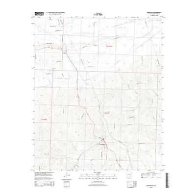
2014 Map of Washington
USGS Topo · Published 2014About this map
Washington serves as a focal point in the southern portion of this Hempstead County landscape, where the street grid includes SW Carrol St, Columbus St, and SE Lawrence St. The area's settlement pattern is defined by its proximity to several drainage systems, most notably the Middle Fork Ozan Cr and S Fork Ozan Cr, which flow through the northern and central sections. To the north, the small community of Ozan sits at the intersection of Us-278 and Mulberry St. Genealogy researchers will find several well-defined burial grounds, such as Saint Peter Cem in the northwest corner and Belk Cem situated west of the main road corridors. The landscape is also marked by several remnants of hydrological shifts, indicated by labels for Old Channel near the northern boundary.
Find a feature on this map
56 named features on this map. Tap any name to fly to it.
Don’t see what you’re looking for? This feature index may not catch every label — zoom into the map to look around manually.
Map Details
Editions of this 2014 Washington Map
This is the sole edition of this map. No revisions or reprints were ever made.
Other maps of this area

1951 · Blevins
USGS Topo · 1:24,000

1951 · Columbus
USGS Topo · 1:24,000

1951 · Sheppard
USGS Topo · 1:24,000

1951 · Nashville
USGS Topo · 1:24,000

1951 · Washington
USGS Topo · 1:24,000

1951 · Pisgah
USGS Topo · 1:24,000

1951 · Hope
USGS Topo · 1:24,000

1951 · Mc Nab
USGS Topo · 1:24,000

1951 · McCaskill
USGS Topo · 1:24,000

1953 · El Dorado
USGS Topo · 1:250,000