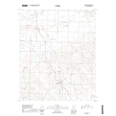
2020 Map of Washington
USGS Topo · Published 2020About this map
Washington serves as a prominent focal point in this portion of Hempstead County, where the historic road network converges. The town's grid is defined by streets such as Mulberry St and Locust, illustrating a well-established settlement pattern that has persisted through the decades. To the north, the smaller settlement of Ozan marks the landscape near the drainage of Middle Fork Ozan Cr. The terrain is deeply inscribed by a complex network of county roads, including Hempstead 22 Rd and Hempstead 16 Rd, which connect rural homesteads and agricultural tracts.
Find a feature on this map
62 named features on this map. Tap any name to fly to it.
Don’t see what you’re looking for? This feature index may not catch every label — zoom into the map to look around manually.
Map Details
Editions of this 2020 Washington Map
This is the sole edition of this map. No revisions or reprints were ever made.
Other maps of this area

1951 · Blevins
USGS Topo · 1:24,000

1951 · Columbus
USGS Topo · 1:24,000

1951 · Sheppard
USGS Topo · 1:24,000

1951 · Nashville
USGS Topo · 1:24,000

1951 · Washington
USGS Topo · 1:24,000

1951 · Pisgah
USGS Topo · 1:24,000

1951 · Hope
USGS Topo · 1:24,000

1951 · Mc Nab
USGS Topo · 1:24,000

1951 · McCaskill
USGS Topo · 1:24,000

1953 · El Dorado
USGS Topo · 1:250,000