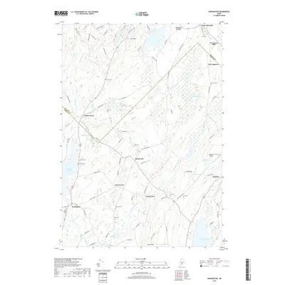
2018 Map of Washington
USGS Topo · Published 2018About this map
Washington and North Union sit within a landscape defined by the drainage basins of the Medomak River and the Saint George River. This interior section of Maine is characterized by a high density of small family and community burial grounds, including the Hannon Cem, Weymouth Cem, and Skidmore Cem, reflecting the deep ancestral roots of the local hamlets. Small-scale settlements like Burkettville, Lucas Corner, and South Liberty are connected by a network of rural roads such as Collinstown Rd and Fishtown Rd. The terrain is punctuated by significant rises such as Coon Mtn and Appleton Ridge, with the latter overlooking Appleton Ridge Pond. The presence of numerous brooks and ponds, including Newbert Pond and Sennebec Pond, underscores the importance of local water systems to the historical development of these townships near the Waldo and Knox County line.
Find a feature on this map
91 named features on this map. Tap any name to fly to it.
Don’t see what you’re looking for? This feature index may not catch every label — zoom into the map to look around manually.
Map Details
Editions of this 2018 Washington Map
This is the sole edition of this map. No revisions or reprints were ever made.
Other maps of this area

1904 · Rockland
USGS Topo · 1:62,500

1906 · Rockland
USGS Topo · 1:62,500

1913 · Waldoboro
USGS Topo · 1:48,000

1915 · Waldoboro
USGS Topo · 1:62,500

1915 · Belfast
USGS Topo · 1:62,500

1916 · Liberty
USGS Topo · 1:62,500

1917 · Belfast
USGS Topo · 1:62,500

1941 · Belfast
USGS Topo · 1:62,500

1941 · Rockland
USGS Topo · 1:62,500

1941 · Waldoboro
USGS Topo · 1:62,500