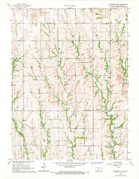
1966 Map of Washington NW
USGS Topo · Published 1967About this map
Washington County State Park serves as a prominent landmark in this 1960s landscape, showcasing the rural character of Washington County. The area is defined by its dendritic drainage patterns, with Jones Creek and Skull Creek cutting through the terrain of Lowe and Farmington townships. Local heritage is preserved through community sites such as SS Peter and Paul Ch and the Greenfield Cem, providing essential points of reference for genealogists. The map also documents modern utility infrastructure, tracing a Pipeline that bisects the rolling uplands between Gray Branch and Riddle Creek. This survey reflects the agricultural nature of the region just before significant modern shifts, detailing the section-line roads and homesteads that structured life in northern Kansas.
Find a feature on this map
13 named features on this map. Tap any name to fly to it.
Don’t see what you’re looking for? This feature index may not catch every label — zoom into the map to look around manually.
Map Details
Editions of this 1966 Washington NW Map
This is the sole edition of this map. No revisions or reprints were ever made.
Other maps of this area

1893 · Washington
USGS Topo · 1:125,000

1955 · Manhattan
USGS Topo · 1:250,000

1955 · Lincoln
USGS Topo · 1:250,000

1956 · Manhattan
USGS Topo · 1:250,000

1957 · Manhattan
USGS Topo · 1:250,000

1957 · Lincoln
USGS Topo · 1:250,000

1958 · Lincoln
USGS Topo · 1:250,000

1960 · Fairbury SW
USGS Topo · 1:24,000

1960 · Reynolds
USGS Topo · 1:24,000

1966 · Morrowville
USGS Topo · 1:24,000