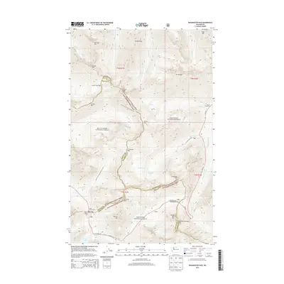
2014 Map of Washington Pass
USGS Topo · Published 2014About this map
The high alpine crest of the Northern Cascades is defined here by the intersection of three major national forests and several high-altitude mountain passes. Washington Pass and Rainy Pass serve as the primary conduits for the N Cascades Hwy, also known as HWY 20, which winds through the mountain ranges of the Okanogan, Mount Baker, and Wenatchee National Forest. This region is a critical corridor for backcountry travel, marked by the presence of the Pacific Crest National Scenic Trail as it traverses north toward Methow Pass. Notable landmarks like Liberty Bell Mtn and the Early Winters Spires tower over the highway, while the Rainy Pass Trailhead and Lone Fir Campground provide established access points to the surrounding wilderness. Glacial features are evident in the numerous lakes, including Rainy Lake and the Snowy Lakes, which feed the headwaters of Early Winters Cr and Granite Cr.
Find a feature on this map
53 named features on this map. Tap any name to fly to it.
Don’t see what you’re looking for? This feature index may not catch every label — zoom into the map to look around manually.
Map Details
Editions of this 2014 Washington Pass Map
This is the sole edition of this map. No revisions or reprints were ever made.
Other maps of this area

1902 · Stehekin
USGS Topo · 1:125,000

1904 · Stehekin
USGS Topo · 1:125,000

1920 · Slate Pass
USGS Topo · 1:125,000

1955 · Concrete
USGS Topo · 1:250,000

1958 · Concrete
USGS Topo · 1:250,000

1962 · Concrete
USGS Topo · 1:250,000

1963 · Washington Pass
USGS Topo · 1:24,000

1963 · Mc Gregor Mtn
USGS Topo · 1:24,000

1963 · Azurite Peak
USGS Topo · 1:24,000

1963 · Slate Peak
USGS Topo · 1:24,000