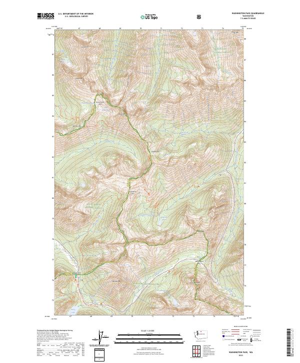
2023 Map of Washington Pass
USGS Topo · Published 2023About this map
Washington Pass and Rainy Pass serve as the primary gateways through the high-elevation terrain where the Okanogan National Forest, Mount Baker National Forest, and Wenatchee National Forest converge. This area is defined by its complex hydrography and alpine peaks, where the headwaters of Cutthroat Creek and Early Winters Creek drain the eastern slopes while Bridge Creek flows to the west.
Find a feature on this map
49 named features on this map. Tap any name to fly to it.
Don’t see what you’re looking for? This feature index may not catch every label — zoom into the map to look around manually.
Map Details
Editions of this 2023 Washington Pass Map
This is the sole edition of this map. No revisions or reprints were ever made.
Other maps of this area

1902 · Stehekin
USGS Topo · 1:125,000

1904 · Stehekin
USGS Topo · 1:125,000

1920 · Slate Pass
USGS Topo · 1:125,000

1955 · Concrete
USGS Topo · 1:250,000

1958 · Concrete
USGS Topo · 1:250,000

1962 · Concrete
USGS Topo · 1:250,000

1963 · Washington Pass
USGS Topo · 1:24,000

1963 · Mc Gregor Mtn
USGS Topo · 1:24,000

1963 · Azurite Peak
USGS Topo · 1:24,000

1963 · Slate Peak
USGS Topo · 1:24,000