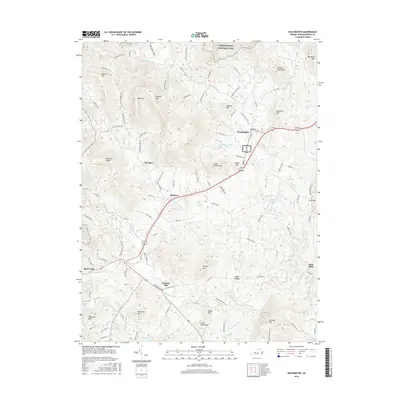
2016 Map of Washington
USGS Topo · Published 2016About this map
The Shenandoah National Park boundary defines the northern reaches of this landscape, where the dramatic Big Devils Stairs overlook a complex network of ridges and watercourses in Rappahannock County. The historic settlement of Washington serves as a primary hub, connected to the village of Sperryville by the Sperryville Pike. The terrain is characterized by a series of prominent peaks, including Massies Mtn, Wolf Mtn, and Menefee Mtn, which frame the valleys of the Rush River and Thornton River. Local industry and heritage are evident in place names such as Fletcher Mill and Rock Mills, while smaller crossroads like Five Forks, Rediviva, and Smedley anchor the rural landscape. This modern survey reflects the enduring pattern of Piedmont settlement, where road names like Rudasill Mill Rd and Schoolhouse Rd point to the location of former community centers.
Find a feature on this map
102 named features on this map. Tap any name to fly to it.
Don’t see what you’re looking for? This feature index may not catch every label — zoom into the map to look around manually.
Map Details
Editions of this 2016 Washington Map
This is the sole edition of this map. No revisions or reprints were ever made.
Other maps of this area

1893 · Luray
USGS Topo · 1:125,000

1905 · Luray
USGS Topo · 1:125,000

1929 · Stony Man
USGS Topo · 1:48,000

1933 · Stony Man
USGS Topo · 1:62,500

1939 · Front Royal
USGS Topo · 1:48,000

1944 · Front Royal
USGS Topo · 1:62,500

1947 · Strasburg
USGS Topo · 1:62,500

1949 · Charlottesville
USGS Topo · 1:250,000

1950 · Strasburg
USGS Topo · 1:62,500

1956 · Charlottesville
USGS Topo · 1:250,000