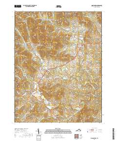
2019 Map of Washington
USGS Topo · Published 2019About this map
The Rappahannock County Courthouse serves as the focal point for the town of Washington, situated at the intersection of Main St and Warren Ave. This area of the Virginia Piedmont is defined by a series of prominent peaks and ridges, including Jenkins Mtn and Wolf Mtn, leading into the eastern boundary of Shenandoah National Park. The local economy and settlement patterns are historically tied to the watercourses, with Fletcher Mill located along the Thornton River and the settlement of Rock Mills positioned where the Rush River flows toward the southeast. Smaller hamlets like Sperryville and Rediviva are connected by the Sperryville Pike, while geographic features such as the Big Devils Stairs indicate the steep transitions between the river valleys and the mountain summits.
Find a feature on this map
114 named features on this map. Tap any name to fly to it.
Don’t see what you’re looking for? This feature index may not catch every label — zoom into the map to look around manually.
Map Details
Editions of this 2019 Washington Map
This is the sole edition of this map. No revisions or reprints were ever made.
Other maps of this area

1893 · Luray
USGS Topo · 1:125,000

1905 · Luray
USGS Topo · 1:125,000

1929 · Stony Man
USGS Topo · 1:48,000

1933 · Stony Man
USGS Topo · 1:62,500

1939 · Front Royal
USGS Topo · 1:48,000

1944 · Front Royal
USGS Topo · 1:62,500

1947 · Strasburg
USGS Topo · 1:62,500

1949 · Charlottesville
USGS Topo · 1:250,000

1950 · Strasburg
USGS Topo · 1:62,500

1956 · Charlottesville
USGS Topo · 1:250,000