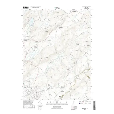
2016 Map of Washington
USGS Topo · Published 2016About this map
The Musconetcong River and Pequest River valleys define the rugged landscape of this northern New Jersey corridor. The borough of Washington serves as a primary hub, surrounded by historically significant settlements like Port Colden and Port Murray, which developed along the path of the old Morris Canal. To the north, industrial history is preserved in names like Pequest Furnace Rd, reflecting the area's rich iron production legacy.
Find a feature on this map
176 named features on this map. Tap any name to fly to it.
Don’t see what you’re looking for? This feature index may not catch every label — zoom into the map to look around manually.
Map Details
Editions of this 2016 Washington Map
This is the sole edition of this map. No revisions or reprints were ever made.
Other maps of this area

1888 · Hackettstown
USGS Topo · 1:62,500

1890 · Easton
USGS Topo · 1:62,500

1890 · High Bridge
USGS Topo · 1:62,500

1891 · Easton
USGS Topo · 1:62,500

1891 · Delaware Water Gap
USGS Topo · 1:62,500

1893 · Delaware Water Gap
USGS Topo · 1:62,500

1894 · Hackettstown
USGS Topo · 1:62,500

1898 · Hackettstown
USGS Topo · 1:62,500

1898 · High Bridge
USGS Topo · 1:62,500

1900 · Raritan
USGS Topo · 1:125,000
Featured Places
- Washington, NJ
- Oxford Township, NJ
- Hope Township, NJ
- Port Murray, Mansfield Township
- Washington Township, NJ