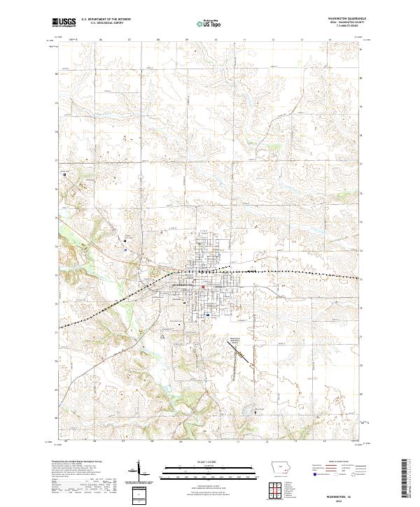
2022 Map of Washington
USGS Topo · Published 2022About this map
The city of Washington serves as the focal point of this Southeast Iowa landscape, anchored by the Washington County Courthouse in the center of a grid that includes E Main St and W Madison St. The surrounding countryside is defined by the winding paths of West Fork Crooked Creek and S Fork Long Cr, which create breaks in the otherwise orderly section lines of Washington County. Genealogists will find several burial grounds documented across the area, from the central Woodlawn Cem and Elm Grove Cem to the outlying Phillips Cem and County Farm Cem. Modern recreational use is represented by the Kewash Nature Trl and Clemons Creek Trails Trl, which follow natural and historical corridors through the creek valleys. To the south, the Washington Municipal Airport sits near the headwaters of the W Fork Crooked Cr, illustrating the modern transportation infrastructure that coexists with the region's agricultural roots.
Find a feature on this map
66 named features on this map. Tap any name to fly to it.
Don’t see what you’re looking for? This feature index may not catch every label — zoom into the map to look around manually.
Map Details
Editions of this 2022 Washington Map
This is the sole edition of this map. No revisions or reprints were ever made.
Other maps of this area

1958 · Davenport
USGS Topo · 1:250,000

1961 · Davenport
USGS Topo · 1:250,000

1962 · Davenport
USGS Topo · 1:250,000

1969 · Kalona
USGS Topo · 1:24,000
1969 · Riverside
USGS Topo · 1:24,000

1969 · Washington
USGS Topo · 1:24,000

1970 · Ainsworth
USGS Topo · 1:24,000
1973 · Wellman
USGS Topo · 1:24,000

1973 · West Chester
USGS Topo · 1:24,000

1980 · Brighton
USGS Topo · 1:24,000