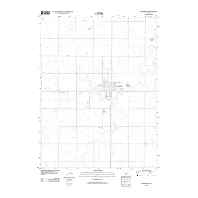
2009 Map of Washington
USGS Topo · Published 2009About this map
Washington serves as the central hub of this North Central Kansas landscape, defined by a grid of rural roads and the winding path of Mill Creek. The settlement's layout is meticulously detailed, showing the residential blocks between N D St and N B St, leading toward the Washington Municipal Airport on the eastern edge. For genealogists, the map is particularly valuable for its documentation of several burial grounds scattered throughout the township, including the Washington Cemetery south of town and the more distant Emmons Cemetery near the small community of Emmons in the northeast.
Find a feature on this map
35 named features on this map. Tap any name to fly to it.
Don’t see what you’re looking for? This feature index may not catch every label — zoom into the map to look around manually.
Map Details
Editions of this 2009 Washington Map
This is the sole edition of this map. No revisions or reprints were ever made.
Other maps of this area

1889 · Marysville
USGS Topo · 1:125,000

1893 · Washington
USGS Topo · 1:125,000

1894 · Marysville
USGS Topo · 1:125,000

1955 · Manhattan
USGS Topo · 1:250,000

1956 · Manhattan
USGS Topo · 1:250,000

1957 · Manhattan
USGS Topo · 1:250,000
1966 · Washington NW
USGS Topo · 1:24,000

1966 · Morrowville
USGS Topo · 1:24,000

1966 · Washington
USGS Topo · 1:24,000

1966 · Hanover SW
USGS Topo · 1:24,000